Monday, July 29, 2013

Back to the US

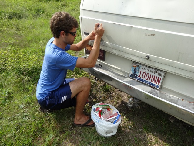
After México City, we were ready to speed back to the States. Since Panamá, we had a mentality of “it just has to make it back to Tulsa.” As much as we enjoyed our surroundings and travels, Chuck was really wanting some garage time and we were ready to be in one location for longer than 2 days. One very visual example of “it just has to make it” was our sliding door panel. The clips were no longer sufficient to hold on the door for very long. We would pound it into place in the morning and hope it would last the day without coming off and keeping the door from opening. By the time we hit the States, it would now longer even stick for 30 seconds, so we had to pull it off and carry it in the van.

You know, we normally equate going north with getting colder, but it did the complete opposite for us. For one, we headed out of the highlands/mountains and down into the high plains. Just as we crossed the Tropic of Cancer, it really felt like the heat and humidity just swamped us. Poor Jonathan had to put up with my grumpiness as a result of the heat. “Honey, don’t talk to me right now, I am too hot.” We literally drove all day long with the windows down to get air, and then when we parked, we try to get wet. Either pool time or shower time to cool down, then we would turn the fans on and read, trying to ignore the heat. Definitely made us want to drive home quickly. But, with our driver’s door dinged in from our mishap in El Salvador, I had been looking into finding another one. However, our current rate would put us going past the most likely shops to have doors on Sunday, when they would be closed. So, we needed to take a day slowly.

We tried to stay an extra day in México, but things just weren’t working out. The movie I wanted to see wasn’t available. The campgrounds were expensive and hot. So we decided to skip our last planned camp site in México and rush to the US. The toll to the newer Colombia crossing was expensive (205 pesos, US$15.53), but the crossing was nearly deserted. We didn’t have to wait in line at all. There is a toll bridge there, though, and I had already gotten rid of all my pesos. They wanted 20 pesos. When I told them we didn’t have any pesos left, they charged us $2. We very nearly didn’t have that either, and had to scrape together some coins to pay it. The US side was pretty tame. I had to throw out an apple, but we didn’t get inspected.

Then we drove over to La Casa Blanca State Park to camp for the night. We took the next day easy since we needed to be in Austin on Monday. We stopped in San Antonio to eat lunch, shop for a few things, and catch a movie before we found our next campground. On Monday, we stopped at Austin Veedub where Jonathan found a door that he liked to replace the dinged one. We stored it in the middle of the van (good thing the door panel was out) and drove to Tulsa as quickly as we could, where we promptly started giving Chuck the attention he was wanting.

DSC05256
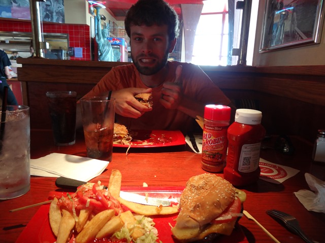
The traditional, good-burger meal when we return to the States.

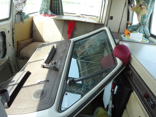
DSC05259The new door. Note: you can see the removed panel resting on the bench seat back. 

Thursday, July 25, 2013

Teotihuacán and Tula

Thursday

We had a small dilemma. On Fridays, because of our license plate and the Hoy No Circula rules, we would not be able to drive at all (not just from 5am-11am like every other weekday). We could either visit Teotihuacán and Tula separately on different days (as originally planned) and not be able to leave until Saturday. Or, we could do them both in one day and also travel out of México City area. I figured it would be cheaper to go ahead and get out of the city.

So on Thursday morning, we went looking for a colectivo to take us to the ruins of Teotihuacán. After walking around and not finding anything that said it was going to “Los Pirámides,” we decided that we would try for a taxi. It was only 30 pesos (US$2.60), so we took them up on the offer and had them drop us off at the Pyramid of the Moon entrance.

It was early, so we enjoyed a leisurely pace with few others around. It was quiet and the weather was quite enjoyable. However, as we slowly progressed towards the very-large Pyramid of the Sun, we began to hear fake jaguar growls and the general clamors of hordes of people. Our quiet, pleasant morning had left us. The one good thing about lots of people is that there is generally someone who is available to take your picture for you.

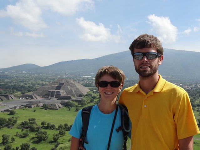
DSC05184 Pyramid of the Moon in the background.

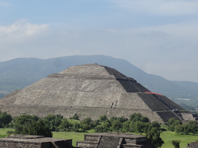
DSC05172 The outrageously-huge Pyramid of the Sun. Though it is believed that it was reconstructed incorrectly, have 5 layers instead of the original four that they now believe it had.

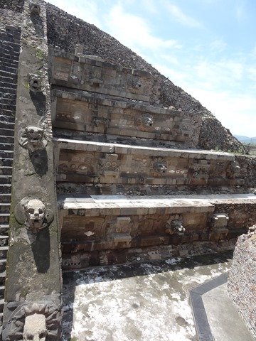
DSC05203 The Temple of Quetzalcoatl.

To get back, we figured we would catch a taxi or something, but we didn’t see any. So, we continued walking on out to the road to see if we could find anything. Just at the entrance as we were crossing the street to the roundabout’s center garden area, I spotted a colectivo that had “S.J. Teotihuacán” on its dash. I waved him down, and he told us it would be 3 pesos (US$0.26) per person. We thought it was a deal and hopped a ride. By now, it was about noon. So we ate lunch, packed up the van, and headed out.

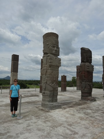
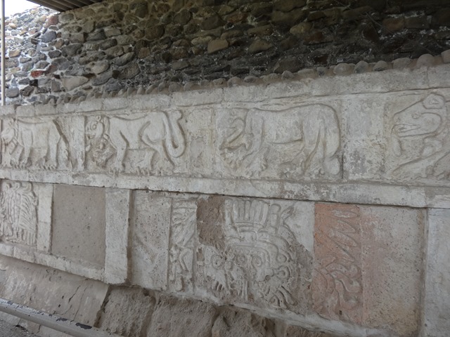
We had heard Tula was a much smaller site, so when we got there, we were surprised to find a full kilometer walk to the ruins from the visitor center. Of course, it was lined with vendors hawking their wares as well. But the real treasure of Tula, the fifteen-foot stone statues of warrior kings, were still impressive.

DSC05235 I think I would make a good statue as well, just wouldn’t have my butt cheeks showing.

DSC05233

DSC05219

After that, we hit the road again. We had planned on going on to San Miguel de Allende, but determined as we were driving that it would be the same amount of driving tomorrow and less today if we stopped in Santiago de Querétaro instead. We made it with plenty of daylight left, as the days keep getting longer as we go north.

Wednesday, July 24, 2013

Explorations of the Big City

Wednesday

Tuesday evening, I had stewed about how to handle the public transportation in and to the city of México. When the owner of the campground we were staying at finally showed up, she gave me lots of information and I thought I had it figured out. However, as I was verifying the process later on the internet, I realized I knew now how to get around the city, but I was confused on how we were to get to the city. So, I went back to the helpful owner of Teotihuacán Trailer Park and asked her how to get to the city. She clarified the matter for me.

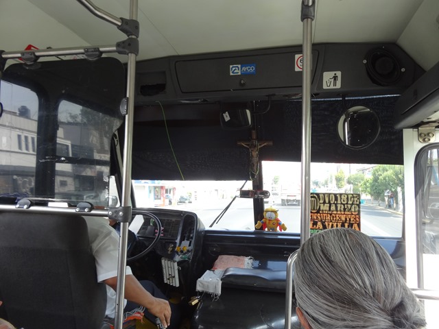
Wednesday morning, we put my understanding to the test. We walked towards the intersection of 25 Regimiento and Vicente Guerrero, where there was a bus station. We bought tickets to go to Deportivo 18 de Marzo station for 30 pesos ($2.35) each. They had provided us four slips of paper, though. I was super confused by this—did it mean that there were two buses that we needed to take, or was one a receipt? Talking to a helpful gentleman there, he explained that brown copy that said “PASAJERO” was the receipt, while the green copy that said “OPERADOR” was the ticket (note: this was really hard to read under the stamp they put on each slip). This bus company was serious. When we entered the bus, many people were frisked to be certain no one was carrying weapons. Then we drove towards the city. They let off a group of people at a random stop on the highway, and then our was the first stop in town. We only knew for certain by asking others were preparing to get off if this was the station, as they didn’t announce the stops or have any signs.

We started following everyone to the next location, which I assumed would be another major bus stop, but turns out everyone was going to the subway. Tuesday I had been given a little paper showing routes for the Metro/Metrobús system. From the conversation I had had with the campground owner, I thought this was for the buses, so I thought we weren’t supposed to go that way. Finding the bus route was a bit harder. I finally asked a set of police officers walking in the area and they pointed us to the intersection where we could find a bus going in the direction we wanted. The fee for the bus was 5 pesos ($0.40) each; we had been expecting 3 pesos ($0.23), but figured it wasn’t that big of deal. As the bus went on, I tried to keep track of stops based upon the map I had been given. Boy was that a learning experience. I got off at what I thought was the appropriate stop, but as I waited for the buses going north and south, I was beginning to think we were in the wrong area. I figured I could be one stop off, so we opted to walk one more city block down. It as at that point that I realized (one of) the issue. The bus had been stopping more frequently than the stops on the map, which looked to correspond to major cross streets. As such, we still had a long way to go westward, so we decided to hop on another bus.
DSC05091

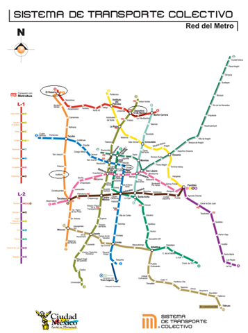
Metro MapThis is the map we were were working off, with the circled stations our destinations. (Click on it for an enlarged view.)

This time, with the assistance of some passengers, we made it to the bus station we had been trying to reach in order to make way south to the Museum of Anthropology. The people on the bus, guided us along. I was super confused as I thought we should have just caught the bus south, for which I had seen signs right after we had alighted. Instead, they took us all around the station to the “Metro” area. We bought tickets, which were the 3 pesos each. Then we descended into the subway system. Turns out the map I had been given was for the subway, not the buses, and we were supposed to be on the subway at Deportivo 18 de Marzo. This was much faster and easier to handle, especially as each stop had names. We quickly made it to our stop at Auditorio to make it to the National Museum of Anthropology.

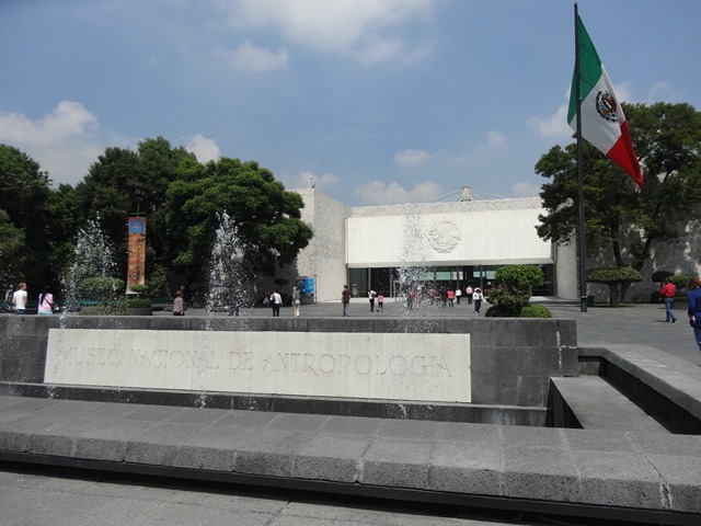
Once up on the surface again, we made our way to the museum. While not even a block away, it felt like we were walking forever past the museum and its grounds. It is one large place. While wandering the museum, I decided I don’t greatly appreciate artifact museums (artwork is a different story). I much prefer seeing the artifact in its context instead of isolated with a small description. I mean, the museum was impressive, but I just prefer things in their original locations. Plus, I felt like it was organized very haphazardly, making it difficult to proceed through the rooms without backtracking or getting out of chronological or topical order. Definitely one of those places where it would be nicer to visit only selection at a time when logical, such as when studying that group, or after visiting the respective ruins.
DSC05092

After only one major room, I was already so hungry I couldn’t stand it and I had forgotten to pack snacks. We decided to check out the restaurant there, but it turns out they only serve breakfast until 1pm, and we couldn’t eat any of the breakfast items. We found out so long as you have your ticket, you can leave and re-enter the museum, so we decided to try the vendors out front. They didn’t have anything really appetizing, so I settled for some dried plantains and Jonathan for a Coke. While wandering about, a group of students studying English approached us and asked for interview for their class. Been there, done that, so I agreed. After we had answered their questions, I asked if there was any food here they recommended. They didn’t suggest anything either—you know it is bad when the locals won’t even eat it. After something to tide us over a little longer, we went back into the museum.
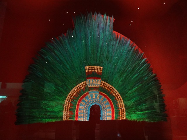
DSC05140 Replica of a headdress they made with Quetzal feathers.

This museum is huge, and by the time we had finished one side, I was ready to zoom through the rest of the exhibitions and move on. I definitely had a hard time appreciating everything there, especially as my feet started hurting more and more.
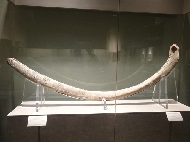
DSC05103 A whale-bone musical instrument. 

Since we were already in the city, we wanted to visit what was left of Tenochtitlán, which is basically the remnants of the Templo Mayor. Heading back to the subway station, we got the train northbound to get on the Line 2 train (the shortest route in regards to the number of trains you have to take). Our destination was Zócalo station in the very center of town. When we got off at Tacuba, we followed the signs to the other line. On the way, we discovered a Domino’s kiosk! I figured we might as well take advantage of it, since we knew we would enjoy that food, whereas picking something random on the street was a crapshoot, even if it was busy. We picked up a personal pan pizza and a water for 20 pesos ($1.60)—quite the steal!
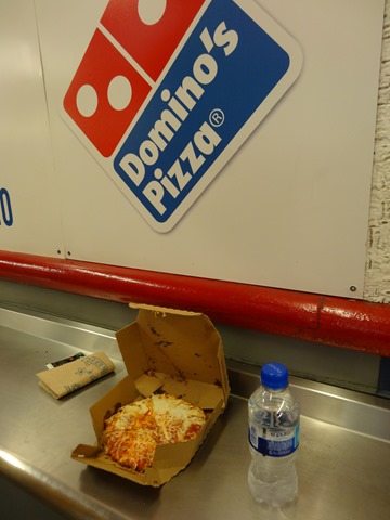
DSC05145

After consuming our late lunch in the station, we began to head towards the subway again. Expecting to pay for tickets to ride this train, we were surprised to learn that we could go anywhere in the subway system on the original ticket, so long as you didn’t leave the station! We were pretty excited to learn that. On the way to our stop, the train stopped a couple of times in between stations…not sure why, maybe they just had to wait on other trains to get out of the way.

When we got off at Zócalo, we surprised by the setup around the square. They had fences set up, and there seemed to be tents in the square. I guess there was some kind of protest/strike going on. Passing on, we walked to the Templo Mayor, well at least what remained of it. There was basically just the foundations on the ground, no height to it, and they were charging 57 pesos per person to get in (same cost as the other parks). For the smile pile of rubble with lack of decorations, we just felt like it was not worth it. So, we decided to take our tired bodies back home.
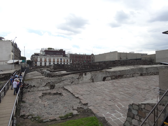
DSC05149

By this time, we were feeling like we were pros at this public transportation network (at least I was). However, perhaps to put me in my place, it turns out I didn’t know how to get back to San Juan Teotihuacán. I had thought that we would just reverse our path and take the same bus back to the town from the Deportivo 18 de Marzo station for 30 pesos ($2.35) each. Well, turns out that that bus doesn’t stop there on the way back. After waiting for 30 minutes, someone finally told us that the bus we were looking for didn’t come this way (earlier I had asked a security guard/ticket agent there if it did, and she said yes—but I guess she was wrong). He told us we needed to go to Potrero station. So, we hopped back on the subway and got off one station farther south at Potrero. We walked around, asked directions, and finally found a bus that said Teotihuacán, but they were going to the pyramids, not the town. The people there said we needed to go the station Autobuses del Norte to get on a bus that would take us straight there. By then, I was very tired, very grumpy, very frustrated, and exactly sure what to do. Jonathan was pretty much in the same boat, so not much help. We decided to try this last destination, and then if that didn’t work, go back to first station, try to get on a bus coming into México, and ride it through its turn around and back to San Juan Teotihuacán.

We made it to Autobuses del Norte, but by this time, it was getting close to 6pm, which is when the last bus departs from the city. We were getting nervous. So, we walked up and down the very large bus station, looking for the bus company we took from San Juan Teotihuacán, which was Linea Autobuses Mexico, Flecha Azul, and represented by a blue pyramid. We couldn’t find it! Just as we were giving up and turning to walk out the door, I saw a very small blue pyramid symbol near the very end of the terminal. We finally found it! I explained where we wanted to go, and the agent hooked us up with two tickets (at 40 pesos each—I guess it was more since it was a slightly greater distance?) for the next bus that left in five minutes, and we still had to go through their security checkpoint. So, we hurried over. This time, we were both frisked, Jonathan 3 times because he set off the alarm with his belt.  Nothing like delays to make you sweat it! We did make it to the bus, but it was in the wrong line, which confused me, but we went up there anyway and apparently it confused the agent as well, but she said all was good and let us on. Relief!  To celebrate, I purchased a strawberry ice cream pop as the vendor made the rounds right before we left.

http://media-cdn.tripadvisor.com/media/photo-s/01/34/e7/f0/el-central-de-autobuses.jpg

Monday, July 22, 2013

The Wonders near Oaxaca

Monday

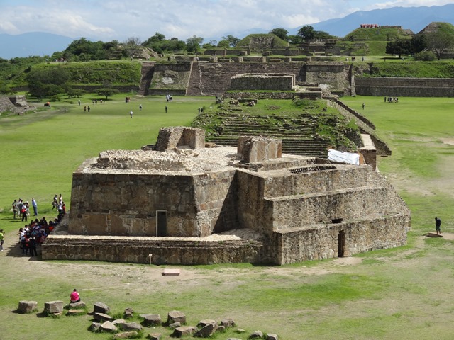
After Villahermosa, we made our way north and west to the center of México, where you can find the remains of other ancient civilizations such as Zapotecs, Teotihuacans, and Aztecs (Mexicans). Our first ruins visit there was to Monté Alban near the city of Oaxaca. It was interesting, with the majority of the plazas laid out in a cardinal grid (unlike the Mayas who seem to lay their cities out haphazardly—probably in accordance with astronomical observations).

DSC05023 The one exception to their north-south-east-west grid, was this building, which is assumed to be a sort of astronomical observatory.

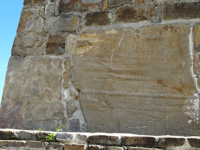
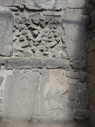
The most interesting thing to me was the carvings. In any large rock that composed a building surface, they put a carving or design on it. Besides all the other difference that were obvious from the Mayans, the use of the canvas of the stone was different. Instead of trying to fill the entire space with runes or drawings, the Zapotecs left lots of empty spaces, focusing on a single figure.
DSC05018

DSC05028

Apparently, the inhabitants of Monté Alban were also obsessed with creating tunnels to connect buildings and such. Unfortunately, we never got to see them.

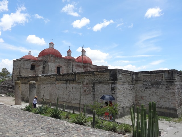
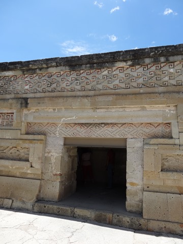
Next on the list was Mitla. I wasn’t expecting much for this one, but it turned out to be one of my favorites. It really is a crying shame that the Catholic Church disassembled quite a few of the buildings to build their own church. The design work was beautiful.

DSC05047 One of the courtyards was used as of the base for the church, then rock was removed from other buildings to build the church up. You can see the church in this picture.

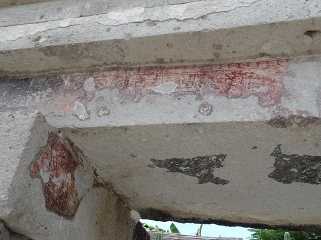
DSC05053 In some areas you can still the remnants of the “plaster” and drawings they had over the doors.

DSC05061I was inspired by the decor; I wouldn’t mind decorating like that. 

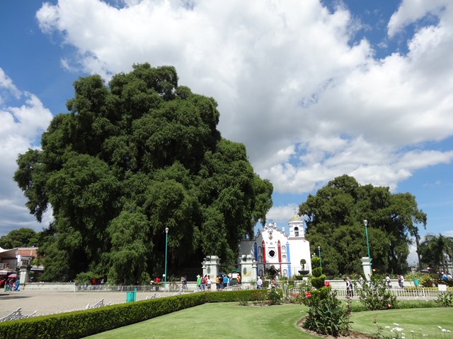
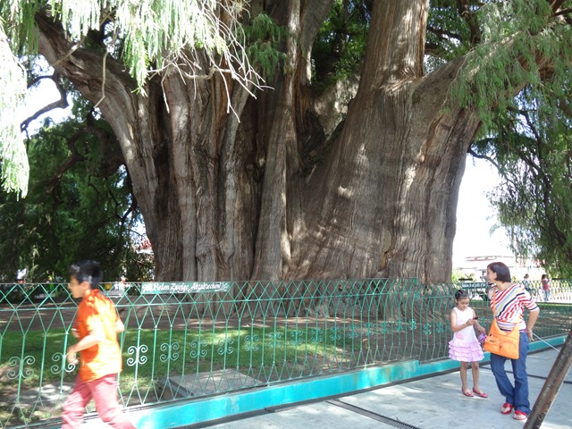
On our way to find our next campground, we stopped in Santa María del Tule where there was a large, 2000-year-old Montezuma Cypress. It was quite impressive, and the birds loved to sit in its branches and tweet.

DSC05083 It is over 40 meters (130 feet) tall.

DSC05081 Its trunk’s circumference is around 54 meters (178 feet), making it one of the broadest tree trunks in the world.

Friday, July 19, 2013

Topes, Topes, and More

Thursday

Leaving Huehuetenango, we immediately started encountering more topes. Between Huehuetenango and the border, we probably nearly doubled the number of topes we had passed over. Sadly, this was just a foreshadowing of what we would experience once we crossed the border.

When we got to the border, the longest and hardest part was weaving through the streets, trying to avoid people in the markets on the street. Other than that, we quickly passed through the inspections and cancelations of paperwork, crossed over into México, and got our new visas. We already a valid vehicle permit, so we were able to skip that step. Shortly, were cruising down the road and encountered our first 110km/hr (68mph) sign since the last time we were in México. We were excited. That didn’t last long, only about 2 km, before the speed decreased and we started in on the super tope run. Seriously, we encountered 310 topes (yes I counted them) in the 364km distance from the Mexican border to our campground in Palenque. Our average speed was even less than in Guatemala (43km/h versus the 45km/h in Guatemala over the tope region). Every small town had an average of 5 topes.

To top of the annoyance with the topes, the weather was almost instantly more hot and humid than it had been in Guatemala, where we had spent our time in the highlands. It really wasn’t that hot, but the humidity just made everything miserable. Between these things and overpriced, under-featured campgrounds, I remember why I wasn’t a huge fan of mainland México. But, at least the temperatures that night were reasonable, especially after a nice shower provided by the van.

Friday

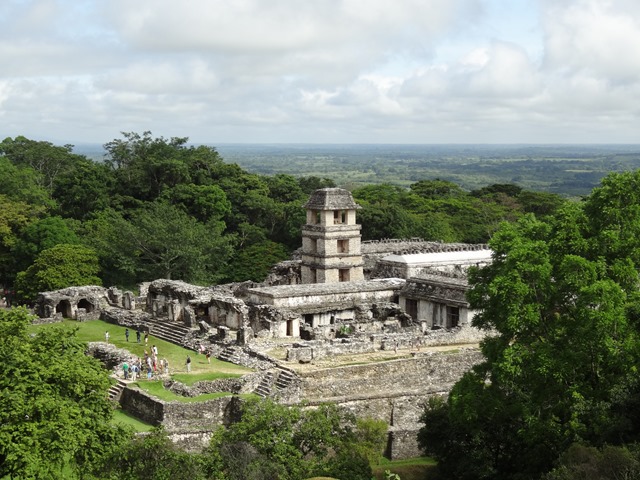
By the time we arrived at Palenque at 8:15, the front parking lot was full, as well as most of the back parking lot. I was amazed about how busy the place was, especially with locals. So, when we got in, we decided to make our way “backwards” around the park, in the opposite way most people were going. This ended up being a good choice, allowing us to explore the residential groupings mostly on our own.

DSC04940

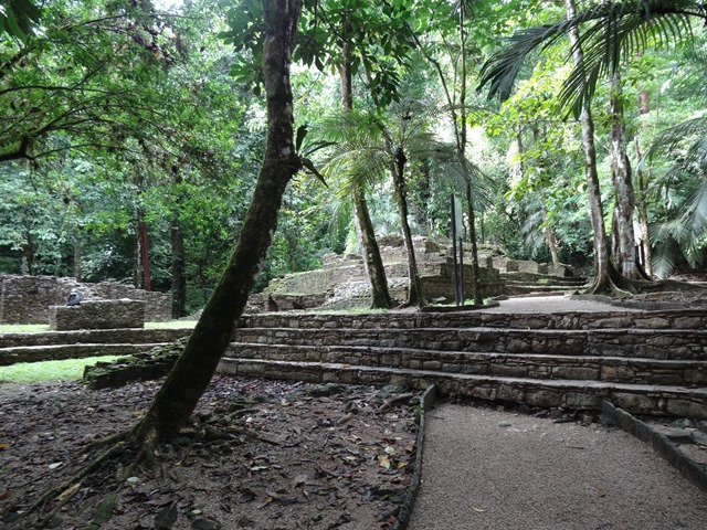
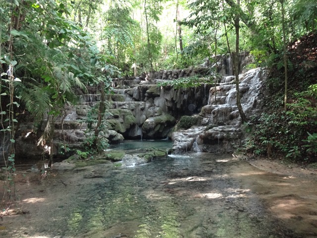
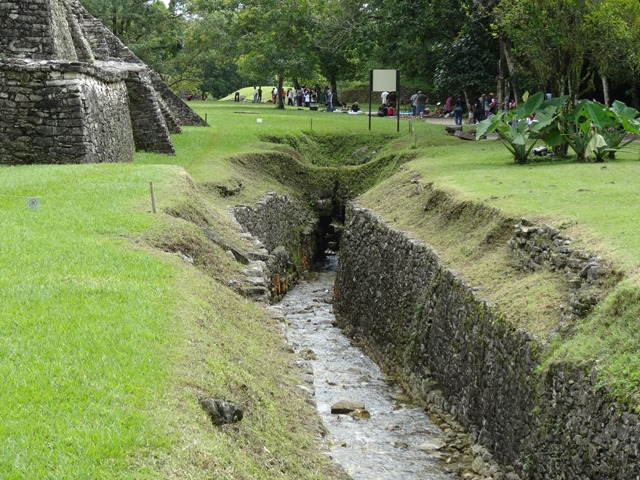
Palenque was a pretty cool site. While walking through the residential areas, you felt like you were one of the first people to find the ruins, as they left most of the trees up. The setting of the place is quite special too. It is at the beginning of the foothills into the mountains. There are several streams that the Mayans controlled and directed, for daily use and protection against floods, as the streams went right through the site.

DSC04936

DSC04968 One of the ancient aqueducts.

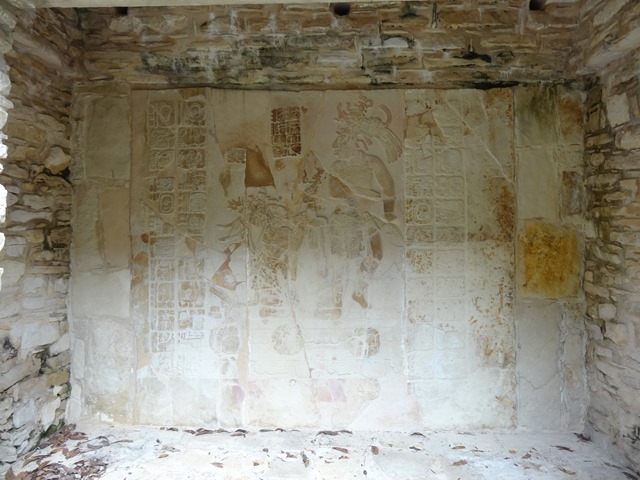
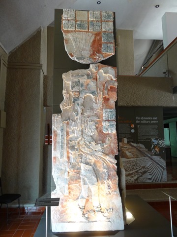
They had several inscriptions that had survived over the years and were really impressive to see. On some of the pieces, you could still see the blue and red colors they used.

DSC04952

DSC04954

DSC04992

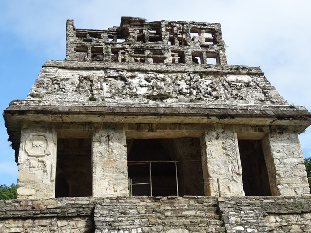
One of my favorite buildings was the Palacio, where there were rooms in the base of the pyramid as well as whole another set of courtyards and buildings at its top in addition to several preserved inscriptions and decorations.

DSC04959

I highly recommend the site. While there, I finally found a hand fan that I liked. I had been looking for one since the last time we were in México, but had been unable to find (a suitable) one. This one was perfect! Doesn’t make up for my lack of hat, but it is a great addition to my collection.

Afterwards, we drove onto Villahermosa, where we camped again at Villahermosa. Since we had all day, I thought we might go to a movie. Besides, an air-conditioned movie was a great way to beat the humidity. I looked online and saw that they were playing Pacific Rim in 2D (we don’t like 3D), subtitled, at 5:20pm. I had originally thought it was 5:40pm, so when we finally caught my error, we were running late. We didn’t get to the theater until 5:30pm, and then I couldn’t find the subtitled 2D version of the movie in the listing. Since we were already there, we settled for The Lone Ranger at 6pm, and decided to grab some Subway for supper. While we were walking around, we spotted another theater—Cinépolis VIP—down the mall. This was the theater with the movie I saw online. Apparently for 100 pesos/ticket, there is a nicer, adult theater with a quiet bar lounge area with plush leather couches. I have no idea what the theater rooms are like, but I am picturing a large theater room in one’s house with leather recliners and such, just a guess though. I mean, I knew Villahermosa was rich—nice streets, three Walmarts, etc.—but I wasn’t expecting a VIP theater. The regular theater was nice enough with high-baked, rocking/reclining stadium seating with air conditioning and a crisp screen.

Thursday, July 18, 2013

April – June Summaries (A Bit Delayed)


I have been trying to do a summary since May probably. Jonathan wanted one, but neither of us got around to doing it, at least partly due to the fact that we didn’t know what to put. So, here are some random statistics that we gathered to the best of our ability after the fact. I am terrible at counting, so I would say that these numbers are +/-20%. Let us know if there is anything else you would like to see on future summaries.

April

May

June

Days Since We Started Traveling:
267
298
328
Miles Traveled This Month:
4,750
2,844
1,875
Miles Traveled Cumulatively (Since Aug):
26,896
29,740
31,615
# of Countries Visited:
2
7
4
# of Countries Visited (Cumulative):
3
9
10
# of States (or Equivalent) Visited:
16
38
22
Average Speed (Mph):
49.5
38.3
35.8
Gas Price Average:
$     3.41
 $     4.35
 $     4.77
Highest Amount Paid for Gas:
$     3.70
 $     5.91
 $     5.66
Arizona
Belize
Costa Rica
Lowest Amount Paid for Gas:
$     3.32
 $     3.26
 $     3.92
México
México
Panamá
Approximate # of Topes (Speedbumps):
500
20
20
Lbs. of Peanut Butter Consumed (Since Apr.1):
8
# of Police or Military Checkpoints Stopped/Passed:
8/12
12/15
2/3
Vehicle Repairs/Inspections on The Road:
6
3
7
Repairs/Inspections
Oil change
Tire pressure
Suspension Lube
Fuel Filter x2
Andamos de Vagos Van
Boats

Wednesday, July 17, 2013

A Second Pass Through Guatemala

Monday

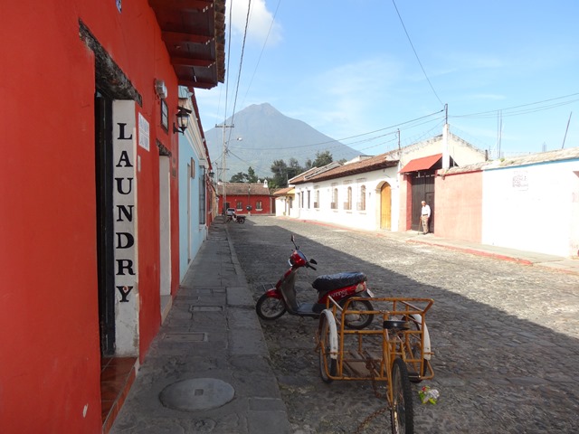
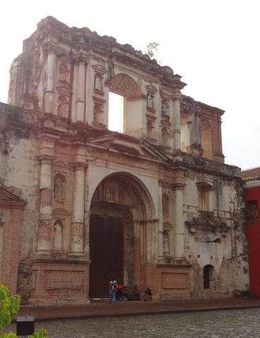
We took off from Hotel El Canja in Chiquimula and drove all the way to Antigua. Fortunately, most of the highway was a four-lane, divided highway, which made the long drive easier. We even had enough time left by the time we arrived to arrange to get some laundry done and do some shopping. Colonial cities are interesting—there are tons of churches, cobblestoned streets, uniformity to the buildings.

DSC04842

Although there is plenty of things to do in and around Antigua, we only stayed the night. We had already seen a lot of volcanoes, etc.

DSC04836

We went shopping for a few items, including a stop at the chocolate museum. We sampled their chocolates. I only tried the white chocolate, but I discovered I am not a fan, about the only white chocolate I can stand is that which coats Reese’s white chocolate peanut butter cups and Hershey’s special edition white chocolate and cranberry bar. Jonathan tells me that is more sugar and fat than any chocolate, which would explain it. On the way back, we passed a delicious-smelling bakery, where I picked up some banana-nut bread.

We stayed at the Asistur (tourist police) complex. They allow RVers to camp there for free, although donations are accepted. The place had a bit of a rough quality to it, though. Kinda looked like the block had been burned down before it was inherited by the tourist police.

DSC04839

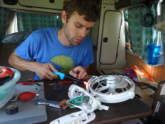
Our morning had started off poorly when the front, swivel fan stopped working—at least usefully. It would turn on only in specific directions, like straight down, which wasn’t helpful. Handyman that my husband is, though, when we got to Antigua for lunch, he pulled off the fan, diagnosed the problem and fixed it. Later, with a vengeance,  he also removed the obnoxious reflective stickers we had to have for Honduras.

DSC04832

DSC04835

While we were there, some place in Antigua seemed to shoot off something every hour. At first we thought it was a bomb, or something, it was that loud. But as no one seemed to react to it, we figured they were just target shooting guns. Then we discovered that it would happen at about every hour. As we began our workout that evening, they started shooting a display of fireworks from the same location from which the sounds had been coming. Not sure if July 15 is special to Antigua or Guatemala, but the display was nice, if a bit loud.

Tuesday

From Antigua, we headed to Lago de Atitlán. Instead of following CA1, we followed the JED's (the GPS) instructions to a more “direct” route. I don’t know if it can be claimed to be shorter with all the switchbacks we went on that weren’t on the GPS route, but it wasn’t too bad. It did eventually degrade to a dirt-road mountain pass, but it wasn’t near as bumpy or as narrow as the road we took to Semuc Champey, so were good.

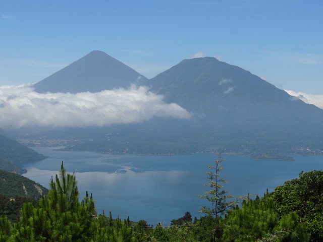
Atitlán is apparently a lake formed a long time ago from a crater of a volcano. Driving along the rim of the old volcano, it is incredible to think that there was volcano big enough to create this six-mile-diameter lake. I know there has been erosion and all that, but still…That is one large volcano!

DSC04863 In the background, you can see two more volcanoes (with much smaller craters).

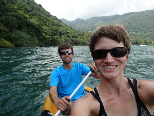
Although Aldous Huxley has described Atitlán as the most beautiful lake in all the world (it is beautiful), I personally would say that Lago de Yojoa in Honduras was prettier. That didn’t keep me from exploring its pretty shores from my kayak.

DSC04869

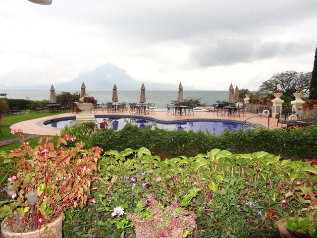
That evening, we decided to eat out at Hotel Atitlán, supposedly the most elegant place to eat in Panajachel. The food was mediocre, but the view and the gardens were great. Unfortunately, it started raining as we finished eating. We waited as long as we dared, but the rains showed no sign of letting up, so we had to walk the kilometer back to our camping spot in the rain. Weren’t completely drenched, but we were pretty soaked by the time we got back.

DSC04882

Wednesday

We had planned on crossing into México on Wednesday, but I had apparently underestimated the time and distance to the border and to the next camping spot. So instead, we decided to make a stop in Huehuetenango, visit the Zaculeo ruins, and camp.

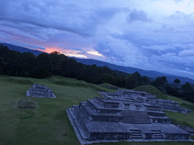
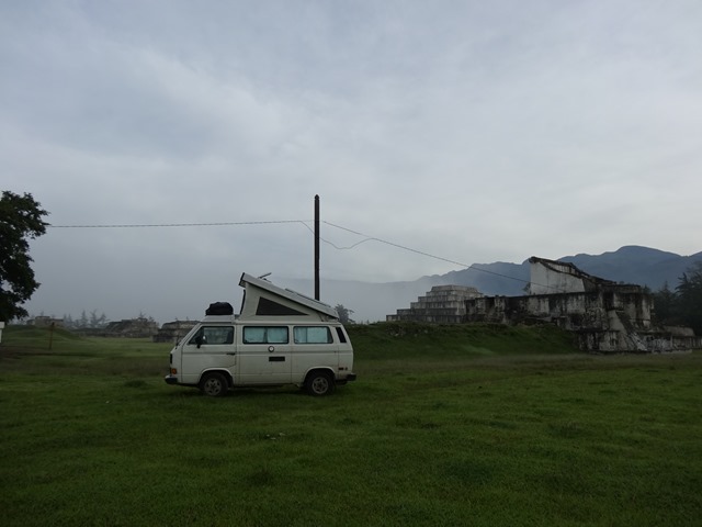
The ruins weren’t large or impressive, especially for the price—Q50pp (US$6.28). The only thing they have going for them is that they are shaped a bit different than the ones that we have seen so far. Very angular. We ended up staying here for the night, they even let us park inside with the ruins, and I got a great view of the sunset from the top of one of the temples.

DSC04912

DSC04916